Hiking from Newfound Gap to Davenport Gap on the Appalachian Trail
After two consecutive years we have officially created a tradition for ourselves – a winter backpacking trip along the Appalachian Trail in between Christmas & New Years.
In 2017, we hiked the first section of the trail from Springer Mountain to Neel Gap and this year, in 2018, we dedicated our trip to the northern half of Great Smoky Mountain National Park from Newfound Gap to Davenport Gap.

Although winter camping doesn’t sound like the ideal way to spend one’s hard-earned vacation time, there are some clear benefits of hitting the trail in the winter when weather and temperatures aren’t the average person’s definition of ideal.
- Minimal crowds & more space in shelters and campsites
- New and unobstructed views
- Absolutely no mosquitos, ticks, or spiders
- A winter wonderland of quiet and solitude
Winter camping can be downright challenging and sometimes uncomfortably cold but it is also one of the most rewarding and therapeutic experiences at the same time – pretty much the definition of type-two fun. I can’t tell you exactly why we do it, or why we keep doing it, but we always enjoy our winter trips and don’t plan to stop anytime soon.
See below for a complete outline of our Smoky Mountain backpacking trip and guide for planning a trip yourself!
Table of Contents
- Trip Map
- Trip Overview
- Itinerary
- Total Trip Cost Breakdown
- Appalachian Trail Route Planning
- Smoky Mountain Backcountry Permits
- Smoky Mountains Shelters
- Long-Term Parking
- Appalachian Trail Shuttle
- General Resources
AT Section Hike Route Map
Great Smoky Mountain Trip Overview
- Great Smoky Mountain National Park
- Start: Newfound Gap
- End: Davenport Gap
- Miles Hiked: 33.3
- Total Time: 3 Days, 2 Nights
- Cost: $365.00 (for 2 people)
We absolutely loved backpacking this section of the Appalachian Trail – from the breathtaking views to the blue-tinged landscape and the constantly-changing scenery and biodiversity at different elevation levels. We started our trip with zero expectations for Great Smoky Mountain National Park and left in disbelief of how much we loved it!


Unpredictable Smoky Mountain Weather
Despite a dismal weather forecast in combination with excessive rain and severe flooding to start our hike, we had a pretty seamless trip. The weather miraculously cleared up and the road closures lifted a few hours after our planned start time.
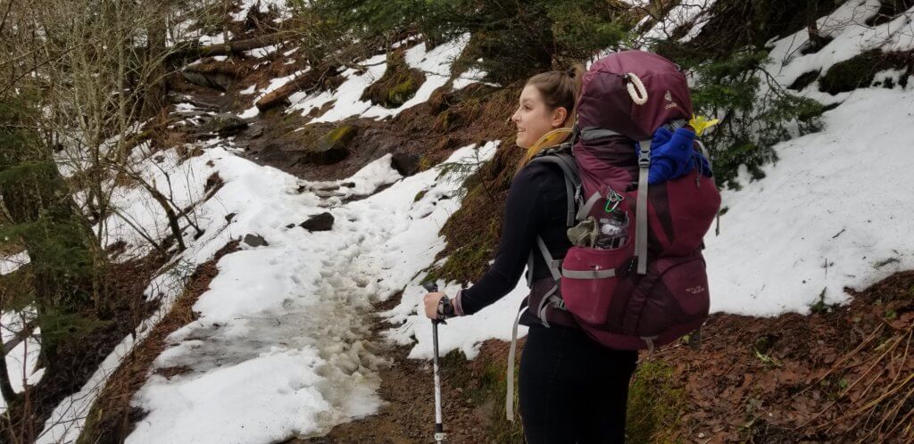
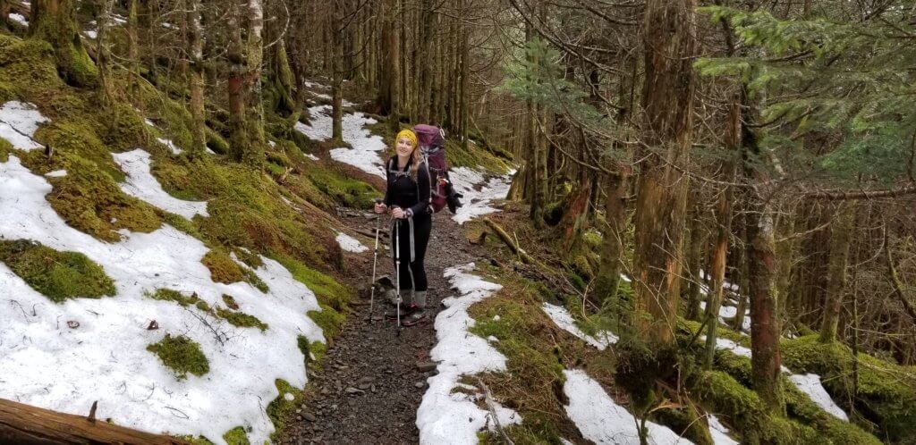
From that moment on, we had perfect weather: clear skies, low wind, and an average daytime temperate of 50 degrees. Despite some slippery snowpack on the trails and soggy boots from the heavy rainfall, we really didn’t have anything to complain about!
Our six hour delayed start did result in us having to finish the last three miles of our first day in the dark. However, being well equipped with reliable headlamps and trekking poles, it wasn’t as terrible as it sounds. We also weren’t the only hikers caught on the trail after dark!
Exposed Ridgeline Trails and Breathtaking Smoky Mountain Views
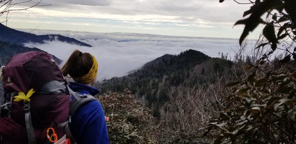
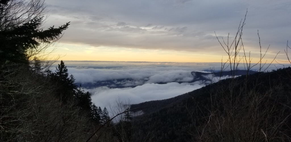
At some points of our hike it felt like we were trekking through the Rocky Mountains – not Appalachia. The high elevation and exposed ridgeline trails provided breathtaking views overlooking the western edge of the mountain range and miles of thick forest. The low hanging clouds hid the all signs of civilization below and made it feel like we were literally standing on the edge of the world. In one word, it was magical.
The viewpoint highlights of this section of trail include Charles Bunion (4.4 miles north from Newfound Gap) and the Mount Cammerer Fire Watchtower (5.1 miles south from Davenport Gap). These two iconic points have some of the best views in the entire park and are worth the stop. There is a 1.2 mile out and back access trail from the Appalachian Trail to Mount Cammerer, so we hid our packs in the forest to avoid carrying unnecessary weight for the extra distance. Plus, it felt sooo amazing to hike without them for a short while!

Future Smoky Mountain Vacations
After spending four days in and around the national park, we both agreed that we need to return to the Smokies – either for another section hike or a road trip vacation (or maybe both!) Like most trips, we felt like we left without even scratching the surface of the park. From Cades Cove to Clingman’s Dome and everything around and in between, there is so much to see, do, and explore along the Appalachian Trail and in the Smoky Mountains! We will get back to Great Smoky Mountain National Park again one day – hopefully soon!

Smoky Mountain Appalachian Trail Backpacking Itinerary
We have outlined our daily mileage, hiking hours, and overnight accommodation of our trip below. For this section hike, we highly recommend hiking the Appalachian Trail north bound. Heading this direction, the trail has less of an elevation gain throughout and is primarily downhill – and consequently mostly uphill heading southbound.
Day #1: Hiking From Newfound Gap to Pecks Corner Shelter
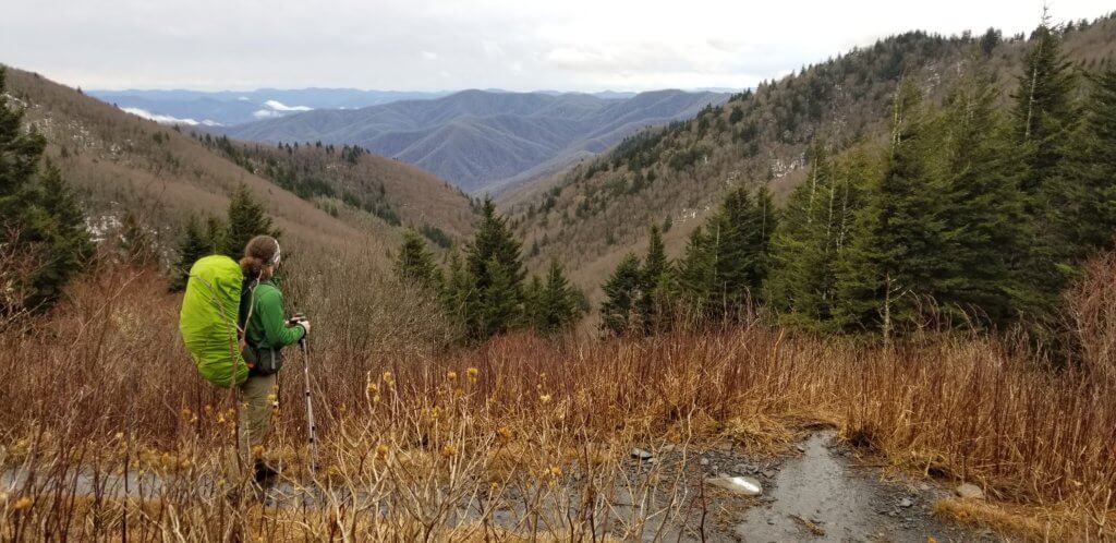
This section of the trail had the best views of the entire hike! Most of the trail follows the western ridge of the mountains giving you breathtaking views well above the clouds and any sign of civilization. You will pass the iconic Charles Bunion 4.4 miles from Newfound Gap but the views continued for over 8 miles of our day.
- Miles: 11.0 miles
- Hours: 6:44
- Elevation Gain: 2,531 feet

Day #2: Hiking From Pecks Corner Shelter to Cosby Knob Shelter
Today’s section of trail comprised of ridgelines and rolling hills as we climbed and descended in elevation. Towards the end of the day we had lost about 1,600 feet in elevation and started to see more sheltered and densely-forested sections of trail while our vantage points lessened in frequency.
- Miles: 12.7
- Hours: 8:02
- Elevation Gain: 2,712 feet

Day #3: Hiking From Cosby Knob Shelter to Davenport Gap
Our last day mostly comprised of hiking downhill, sans a 1.5 mile climb to start our day. We opted to detour an additional 1.2 miles with a stop at the Mount Cammerer Fire Watchtower for an amazing overlook of the mountains. The scenery and plant life continued to change as we descended another 2,500 feet in elevation to our ending point at Davenport Gap.
- Miles: 9.6
- Hours: 4:47 (we were CRUISING to try & meet our shuttle!)
- Elevation Gain: 1,434

Trip Cost Breakdown:
Once you have all the gear, backpacking is a relatively inexpensive hobby and way to travel without breaking the bank. The total cost for our four day trip to the Smoky Mountains was $364.24 for two people including all expenses.
- Gas & Tolls: $113.27
- Round Trip from Milwaukee, WI to Gatlinburg, TN
- Smoky Mountain Backcountry Permits: $16.00
- 2 nights, 2 hikers
- Appalachian Trail Shuttle: $90.00
- 5 hour shuttle ride for 2 people
- Fast Food and Snacks: $79.70
- 4 meals, coffee, and snacks for 2 people
- Backpacking Groceries: $53.82
- 3 days of trail food: 3 meals a day for 2 people
- Pre- and Post-Hike Accommodation: Free
- We were lucky enough to stay with family pre-hike and friends post hike to help keep our costs low!
- Otherwise, there are a few hiker hostels available in the area for a reasonable price or budget hotels in Gatlinburg or Pigeon Forge.
- We were lucky enough to stay with family pre-hike and friends post hike to help keep our costs low!
Smoky Mountain Backpacking Routes
Before you can even think about buying a Smoky Mountain backcountry permit, scheduling a hiker shuttle, or packing your backpacking gear, you need to first plan your route. Given the vast expanse of different trails and scenic viewpoints in the Smokies, this is easier said than done.
Our advice – first examine your time availability, level of fitness, and trail interests and then determine whether you want to complete a one-way section hike or a roundtrip backpacking loop hike. There are pros and cons to each, but no matter which you choose there are a plethora of different trails and accommodation options in Great Smoky Mountain National Park to meet your needs and expectations.
One Way Section Hiking in the Smoky Mountains
- Pro: Allows you to cover more ground & see more parts of the park in a shorter amount of time
- Con: Will cost you a shuttle service fee to get to/from your parked vehicle
Round-Trip Backpacking Loop in the Smoky Mountains
- Pro: Free to park and no shuttle needed
- Con: May take longer to see the same parts of the park as a one-way section hike EX: a 3 day section hike may take 5 days as a loop
Appalachian Trail Hiking in Great Smoky Mountain National Park
Once you have selected whether a section or loop hike best fits your needs, you can look at the national park’s general map and trail maps to find routes that match your fitness ability, interests, and time availability.
We chose to complete a one-way section hike along the Appalachian Trail in order to continue with our annual hiking tradition and see a lot of the park even with a time limitation. The one-way route allowed us to hike both the high alpine ridgelines as well as the dense/wet forests at the lower elevations. Had we done a loop hike, we likely would not have been able to experience both in 3 short days because of the high mileage and challenging elevation changes.

Appalachian Trail Trip Planning
Great Smoky Mountain National Park Backcountry Permits:
Once you’ve picked your route and selected your preferred trail shelters and campsites, you are ready to officially book your Smoky Mountain backcountry permits! In contrast to other sections of the Appalachian Trail, you will need to obtain permits from the national park service before you hit the trail.
Permit applications can be found on the National Park Service website. Backcountry permits for the Appalachian Trail cost $4 per person per night and are available on a first come first served basis anytime up to 30 days before your trip. The permit application and fee also include your reservation for a spot in a shelter or campsite for each night in the backcountry as well as permission to park overnight in the park during the duration of your reservation.
Smoky Mountain backcountry permits and shelter reservations fill up extremely fast in the popular summer months and during peak Appalachian Trail through-hiker seasons so it is essential to plan ahead if you plan on backpacking during these times.
However, in the cold winter months when we completed our hike, we bought our permits and reserved our shelters a mere 2 weeks in advance. We didn’t have any issues reserving our preferred shelters and even noticed that there were plenty of backcountry permits and shelter spaces still available the day we started our hike.
Great Smoky Mountain National Park Backcountry Office
For any detailed or specific questions, don’t hesitate to reach out to the park’s backcountry office. We found them to be extremely helpful and knowledgeable about the park and trails and felt comfortable asking them a million questions prior to our backpacking trip.
Even if you’re feeling confident about your backcountry trip, it’s worth a stop to get up-to-date weather information, double check trail conditions, or make any last minute permit changes or updates.
- Smoky Mountain Backcountry Permit Website
- Office Address: 107 Park Headquarters Road, Gatlinburg, TN 37738
- Office Hours: 8:00 AM – 5:00 PM EST
- Phone: 865-436-1297

Smokey Mountain Shelters and Campsites
In the park, all hikers following the Appalachian Trail are required to sleep in a shelter. There is absolutely no tent camping permitted along the trail or outside the shelters. In other sections of the park and along different trail networks there are designated campsites available for backcountry hikers who are not section or through-hiking the Appalachian Trail.
Appalachian Trail Shelters in Great Smoky Mountain National Park
Shelters in the park consist of three walls built from stone and timber with an open fourth side. In the winter the park service also hangs a tarp along the opening to help keep in warmth – which is not the case for all shelters along the greater Appalachian Trail. The inside of most shelters contains two levels of sleeping platforms that can accommodate up to 12 people. Permits in the park are usually issued in quantities based on each shelter’s space availability.
In terms of basic necessities, each shelter is equipped with a reliable, fresh water source, a compostable pit toilet, and bear-proof food storage. Most shelters also have a small fireplace and outdoor community table for hikers to share.

Since we exclusively hiked along the AT on this trip, we only stayed in hiker shelters and did not camp at all. Our first night we stayed at Pecks Corner Shelter and our second overnight was at Cosby Knob Shelter. We selected these shelters because of their perfectly spaced distance in regard to our physical ability and mileage goals for each day.
Although we didn’t use a tent on this trip, we do highly recommend bringing a light-weight tarp for your stay in the park shelters. We encountered a leaky roof one night due to the heavy rainfall and were able to stay warm and dry by hanging our tarp from the ceiling. It’s also helpful to place underneath your sleeping bag to prevent your sleeping gear from getting muddy or dirty.

Hiker Parking in Great Smoky Mountain National Park
Regardless of if you choose to complete a section hike or a loop hike, you will need to park your vehicle for multiple days either at the start or end of your route.
If you opt for a section hike, we recommend parking your car at your end destination and getting a ride to your starting point. This way, you can take your time on the trail and won’t have to rush to meet your driver on time at the end of your hike. If you’re loop hiking you don’t have to worry about strategically parking because your hike will start and end at the same parking location.
Long-Term Parking Safety
Regarding safety, you should carefully research and evaluate the best place to leave your unattended vehicle for a few days at a time. It’s hard to know exactly when and where crime will strike, but there are a lot of resources available to help you to determine the safest place to park your car in relation to your hike.
For both of our Appalachian Trail hikes we consulted multiple threads on the White Blaze hiker forum to learn where other hikers parked their cars and have experienced successes or break ins. For both of our AT section hikes we parked our vehicle for multiple days without any issues at locations we read were safe from other hikers on the forums.

Appalachian Trail Parking Options
In the case of this section of the park, there are a few parking options. The safest two parking options are at Newfound Gap or the Big Creek Ranger Station – both located inside the park.
Although it seems convenient and temping to park directly at the Davenport Gap trailhead – it is definitely not advised. Parking along the road at Davenport Gap is super risky due to its long history of break-ins and vehicle vandalism and theft.
If you’re planning on ending your hike at Davenport Gap, we highly recommend parking at the Big Creek Ranger Station located 1.2 miles down the road from the Appalachian Trail trailhead along the highway. This “ranger station” is un-occupied but conveniently hidden along a dirt access road into the park. Its invisibility and remoteness make it a much safer option than Davenport Gap which is located directly on Highway 32.
If a 1.2 mile road walk back to your car at the end of your hike doesn’t sound appealing and you’re not an AT hiking purist, you can use the 2.1 Chestnut Branch access trail that leads directly from the AT to Big Creek Ranger Station.

Smoky Mountain Shuttle Service:
If you are completing a section hike, you will need to hire a shuttle service to drive you to/from your vehicle to your start or end point.
Shuttles around the Appalachian Trail are usually just everyday people in regular vehicles who have built a small business out of transporting AT hikers and park visitors to different trailheads – not a big bus that runs on a regular schedule.
Most hiker services are completely customizable in terms of drop off/pick up destinations and timing and pricing will vary depending on those factors.
When booking a shuttle service, be sure to exchange the following information:
- Pick up date, time, and location
- Price (per ride or per person)
- Vehicle make and model
- Phone numbers/preferred contact method
- Back up plans for inclement weather

AAA Hiker Service
After combing through some White Blaze forums on area shuttles and calling a few different services we chose to schedule a ride with AAA Hiker Service about 1 week prior to our trip.
We couldn’t have asked for better service or conversation. Our contact, Mark, was super knowledgeable about the Smoky Mountains and great to talk to. He was also an invaluable resource when our initial plans changed last minute due to the heavy rain and area flooding we experienced on our first day.
After the amazing experience we had, we can’t recommend AAA enough! They provided us with unparalleled customer service and were by far the most professional, accommodating, and reasonably priced service in the area. We 10/10 recommend them for any service in the Smokies!
AAA Hiker Service Contact Information
- AAA Website
- Phone: 423-487-3112 or 865-322-0691
- Email: shuttle@AAAhikerservice.com

General Resources For Section Hiking The Appalachian Trail
If you’re planning a trip to the Appalachian Trail to section hike, preparation can feel overwhelming as you try to anticipate new terrain, weather, and other various hiking and trip logistics. Below are some of the resources that we use to plan our destination AT section hikes.

National Park Resources
National park websites and backcountry offices are excellent resources for getting up-to-date park alerts, trail conditions, road closure information, and weather forecasts for the backcountry. We highly recommend calling the backcountry office and checking the website ahead of your trip for any questions or updates – they are always happy to help!
- Great Smoky Mountain National Park Website
- Backcountry Office: 865-436-1297
Note: not all sections of the Appalachian Trail fall within park boundaries, so this resource is not available for all section hikes.
White Blaze
White Blaze contains practical advice from real people on various topics about the AT including forums where other hikers and enthusiasts share tips and advice for various trail sections as well as general trail information.
WikiTrail AT
Wiki Trail serves as an awesome resource for examining elevations, distances, natural resources, and shelters along your designated route. We found this site to be the most helpful while planning our mileage and overnight stops.
AT Weather
Common weather apps are usually not accurate to the trail since they tend to monitor the closest cities to the Appalachian Trail, not the trail itself. AT Weather provides most accurate and up-to-date forecasts by allowing you to select exact points along the AT, not just generalized areas and cities.
Weather in the mountains can change drastically from day to day or even hour to hour so check the forecast frequently a few days before heading out to make sure you’re properly prepared for all potential conditions.
The Appalachian Trail Conservancy
This website is an excellent introduction to the Appalachian Trail; its history, options for experiencing, as well as additional advice and resources to help you properly prepare for your trip.
Travel Blogs (like ours!)
Simply reading about other people’s experiences on a specific sections of trail really helps you prepare for what to expect and pack for your trip. Additionally, reading other blogs may help you learn from the mistakes of others – ensuring you have the best experience. We personally love Darwin On The Trail but there are a ton of different blogs and YouTube channels out there!

Enjoy Your Smoky Mountains Hiking Adventure!
Hopefully this information is useful in helping you start to plan your own amazing backcountry trip to the Smoky Mountains!
Check out our other posts about hiking the Appalachian Trail and our other resources of outdoor and adventure travelers like our backcountry camping checklist and winter layering guide!.


One Comment on “Hiking in Great Smoky Mountain National Park: Appalachian Trail Section Guide”